HSW#06 ROUTE(S)

authenticity -- adventure -- culture

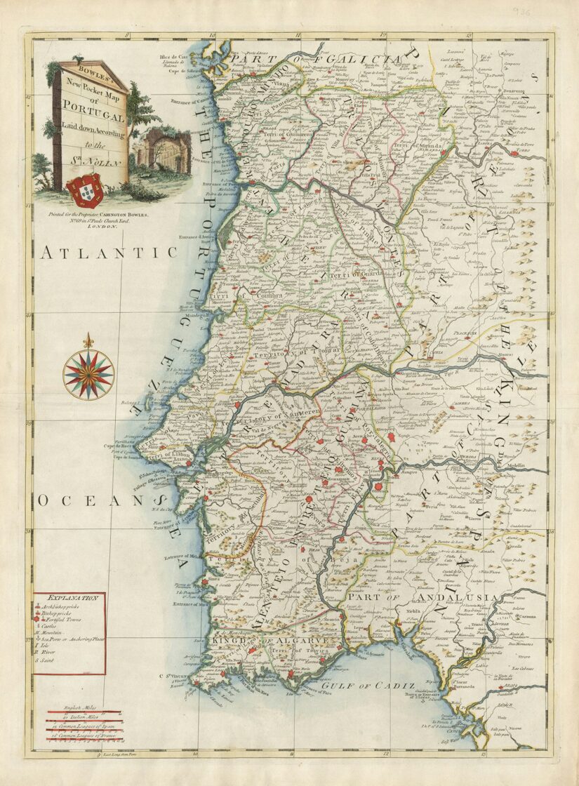
The routes were designed as a journey through the remarkable diversity of Portugal’s landscapes and cultural heritage, crossing the country from the mountains of North and Central Portugal to the plains, hills and Atlantic landscapes of the Alentejo and Algarve.

This journey echoes the work of Portuguese geographer Orlando Ribeiro, whose pioneering studies in the mid-20th century explored the profound relationship between territory, climate, landscape and society in mainland Portugal. In his seminal work Portugal, o Mediterrâneo e o Atlântico (Portugal, the Mediterranean and the Atlantic), Ribeiro described the country through the interplay of two major geographical influences: the Atlantic and the Mediterranean.

Climate, geology and relief have shaped distinct landscapes and ways of life across Portugal, leaving their mark on settlements, agriculture, architecture and cultural heritage. The Central Mountain System and the Tagus valley form one of the country’s most significant geographical transitions, between territories increasingly influenced by Atlantic conditions to the north and Mediterranean influences towards the south.

Heading SouthWest follows this geographical transition on two wheels. The routes are a journey through the contrasts that have shaped the country — from mountains to hills and plains, from granite to schist, from Atlantic landscapes to increasingly Mediterranean ones.

This is an invitation to experience the Portugal described by Orlando Ribeiro: a country whose landscapes reveal, at every turn, the deep relationship between nature, territory and the people who have inhabited it.

PT_OR.jpg

Trás-os-montes region AND sabor lakes

Trás-os-Montes - literally meaning in English "behind the hills". It's landlocked by the Douro and Tâmega valleys to South and West and by Spain to the North and East. This relative isolation has led to the survival of cultural traditions that mark the Portuguese identity. The most emblematic example are the Carnival and Pagan figures of many villages, such Podence. It is also the home of the Mirandese culture and Portugal's second official language.

Route(s): Heading SouthWest Ultracycling & Travessia Nacional Bikepacking.

Douro valley - unesco world heritage site

The Douro Valley is a designated UNESCO World Heritage Site due to its stunning cultural landscape, which is a result of over 2,000 years of winemaking. It is the world's oldest demarcated wine region, famous for producing Porto wine. Its terraced vineyards, charming villages, and the Douro River create a unique and beautiful scenery shaped by both nature and human effort, that our adventurers will experience.

Route(s): Heading SouthWest Ultracycling & Travessia Nacional Bikepacking.

SERRA DA ESTRELA - UNESCO GLOBAL GEOPARK

The Serra da Estrela is the highest mountain range in mainland Portugal. It is home to the country's highest point, Torre, a peak on a plateau, located at approximately 2,000 meters above sea level. Estrela will be the setting at the end of the first third of the HSW journey. Serra da Estrela is also a designated UNESCO Global Geopark and the most emblematic national territory for road cycling.

Route(s): Heading SouthWest Ultracycling & Travessia Nacional Bikepacking.

In 2027, Heading SouthWest will feature two routes: Heading SouthWest Ultracycling [road] and Travessia Nacional Bikepacking [off road] - both heading the Atlantic, on the edge of Europe: Cabo São Vicente, SAGRES.

Heading SouthWest Ultracycling is a 1,000-kilometre on-road adventure with 18,000 meters of elevation gain, crossing Portugal from its rugged northern valleys to the Atlantic edge of the Algarve. The route winds through the spectacular Douro Valley and across the peaks of the Central System, reaching its highest point at almost 2,000 meters above sea level, at Torre in Serra da Estrela. 

Beyond the Tagus River, the landscape changes dramatically. The route enters the rolling hills and wide-open plains of Alentejo. But don't expect a monotonous experience in the land without shadows. The Serra de São Mamede brings a taste of mountain terrain, while a handful of smooth gravel sections add some extra spice to the adventure. 

Then comes the final challenge: climbing Fóia in Serra de Monchique, the highest point in the Algarve and the last major ascent of the journey. The climb rises through the rugged landscape of Monchique, with increasingly dramatic views stretching across the Algarve and towards the Atlantic. From the summit, the route finally turns southwest and the landscape opens towards the coast as the route approaches Cape São Vicente, where the Atlantic horizon marks the end of the journey — and the ultimate finish line.

europeana--bsozST8wGg-unsplash-1.jpg

monsaraz AND alqueva DAM - DARK SKY RESERVE

Crowned on a hilltop, the medieval village of Monsaraz overlooks the vast waters of Alqueva, the largest artificial lake in Western Europe. Part of the Guadiana River, this landscape has long been a natural crossing point. Between ancient walls and endless waters, Monsaraz unites history, resilience and beauty. The silence of the plains meets the boundless horizon, under one of the clearest skies in the world, certified by Dark Sky Reserve.

Route(s): Heading SouthWest Ultracycling

ALENTEJO - THE LAND WITHOUT SHADOWS

We enter the territory of Gravel Birds — the event that sparked interest in bikepacking in Portugal. HSW offers a different perspective, exploring areas that normally fall outside of our sibling event. Travessia Nacional will focus on the Alto Alentejo before gradually drawing closer to the coast. The on-road route will initially stay closer to the border, taking us towards Serra de São Mamede. From there, the route will venture into the heart of the Alentejo.

Route(s):  Heading SouthWest Ultracycling & Travessia Nacional Bikepacking.

atlantic coast - costa vicentina natural park

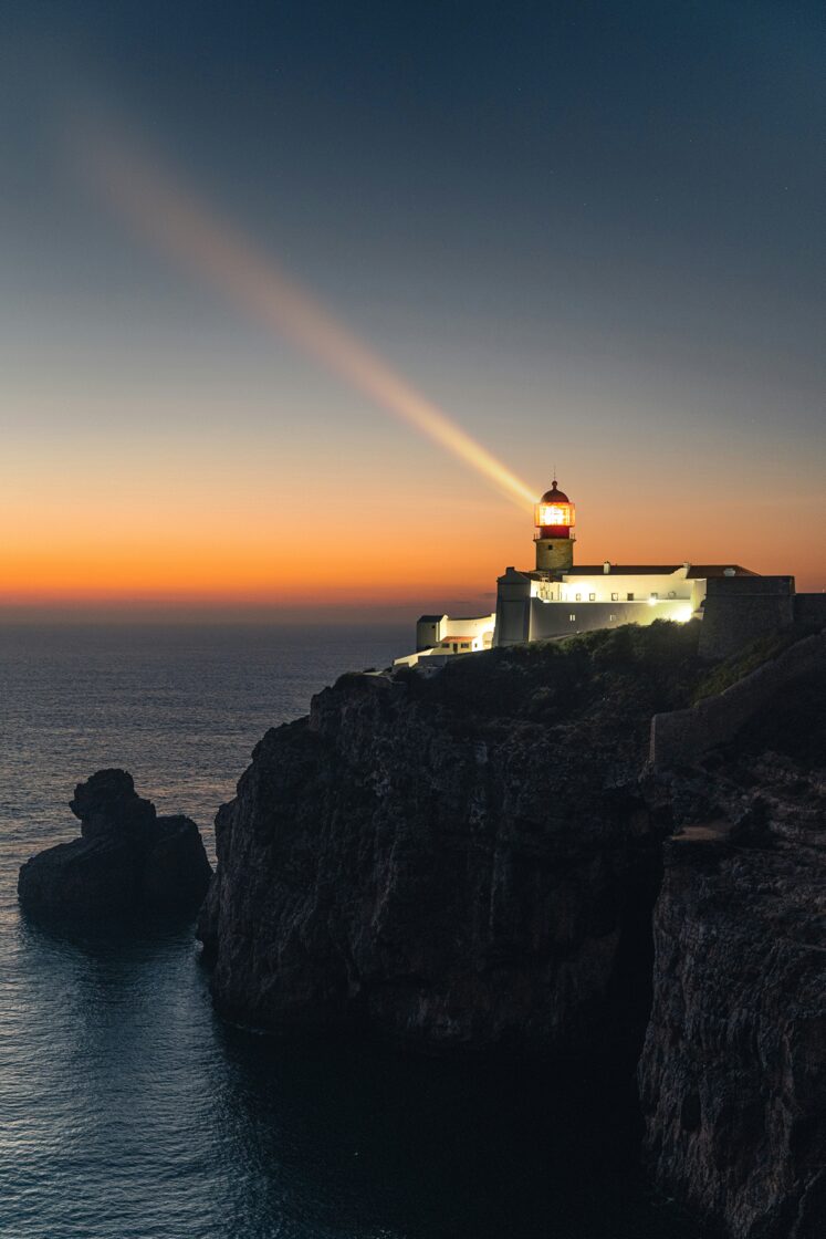
The transition from the Alentejo to the Algarve region and where land meets the sea. This coastal section contrasts sharply with the inland plains, offering dramatic cliffs, winding trails along the cliffs’ edge, and expansive ocean views. Charming fishing villages, now popular with visitors, invite a taste of fresh seafood and a moment to rest. Then, the land will really end heading Cape São Vicente - the ultimate finish line.

Route(s): Heading SouthWest Ultracycling & Travessia Nacional Bikepacking.

Travessia Nacional Bikepacking is a 1,000-kilometre off-road cycling adventure, designed and tested specifically for gravel bikes, with 15,000 meters of elevation gain. Around 60% of the route is off-road, complemented by 40% of secondary paved roads, creating a journey that combines remote gravel tracks, forgotten roads and some of Portugal’s most diverse landscapes.

Starting in Bragança, in the far northeast of Portugal, the route initially crosses the mountains and valleys of the North, following a network of rural tracks, cycling paths and quiet roads through a landscape shaped by centuries of agriculture, forests and small villages. As it moves south, the terrain gradually opens up, revealing the contrasting landscapes of Central Portugal. Long gravel sections alternate with rolling terrain, mountain climbs and remote stretches.

As the route reaches the Alentejo, the landscape changes once again. The mountains give way to vast horizons, cork and holm oak forests, open plains and ancient rural paths. Here, the challenge is less about constant climbing and more about distance, exposure and the sheer scale of the territory.

The final stages lead towards the Algarve, where the terrain becomes increasingly rugged and the Atlantic draws closer. After crossing the southern landscapes, the route converges with the final stretch towards Sagres, reaching the southwestern edge of continental Europe and the Atlantic Ocean.

More than simply an off-road version of Heading SouthWest, Travessia Nacional Bikepacking is a different way of crossing Portugal — eventually slower, following an even more remote approach.

dmitry-voronov-qn5KN52G9CE-unsplash.jpg